EM19 Road 1
.jpg)
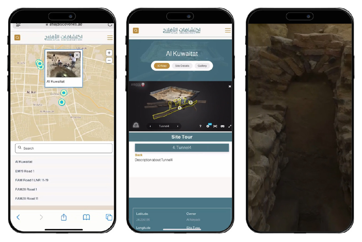
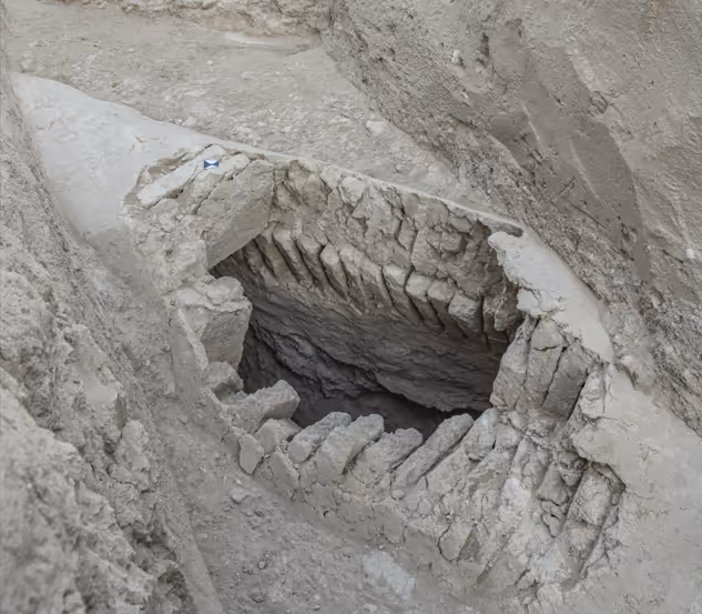
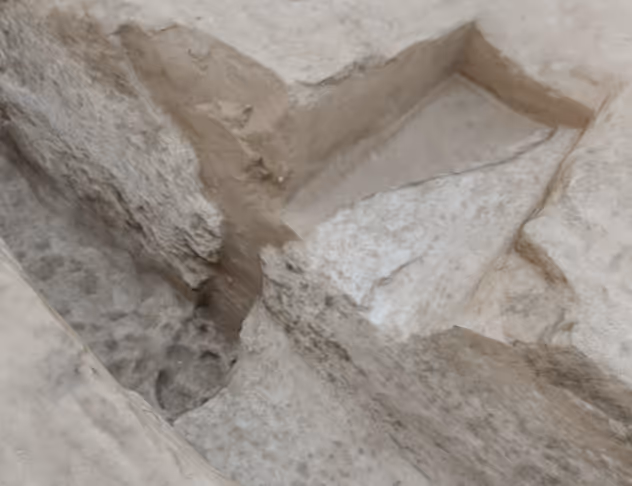
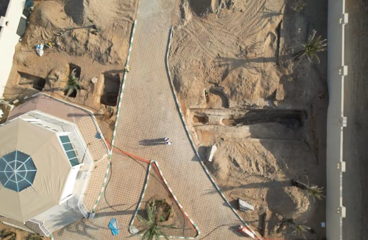
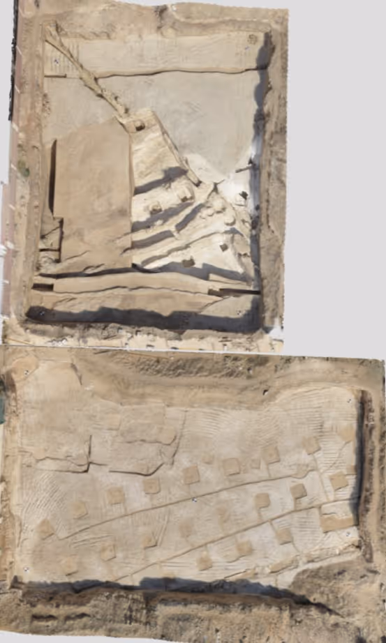
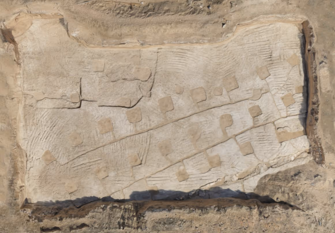
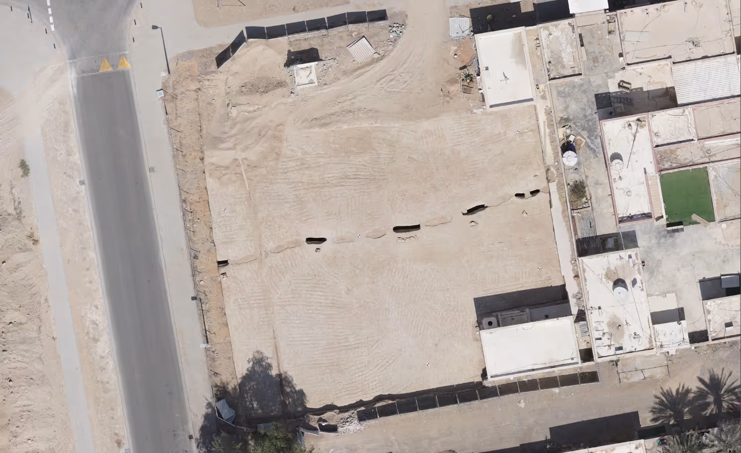
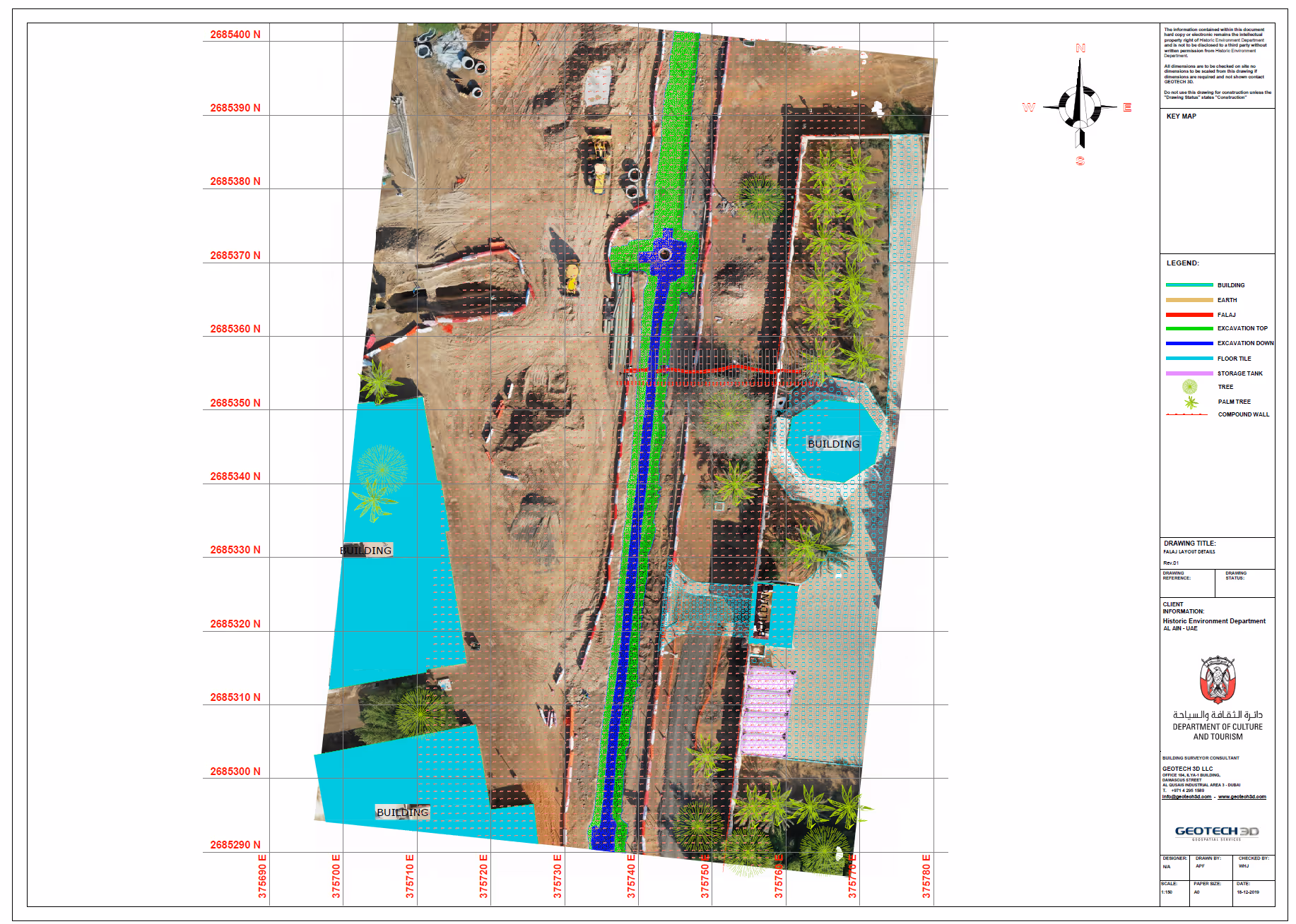
EM Road 1runs from north to south and forms the border between the adjacent shabiyaat of Eidan Al Mahaba (EM) and Falaj Al Mazmi (FAM). Installation of deep storm drains formed a major part of the Al Ain Municipality (AAM) project to upgrade roads and infrastructure in these areas, and this road was the first to be archaeologically monitored.

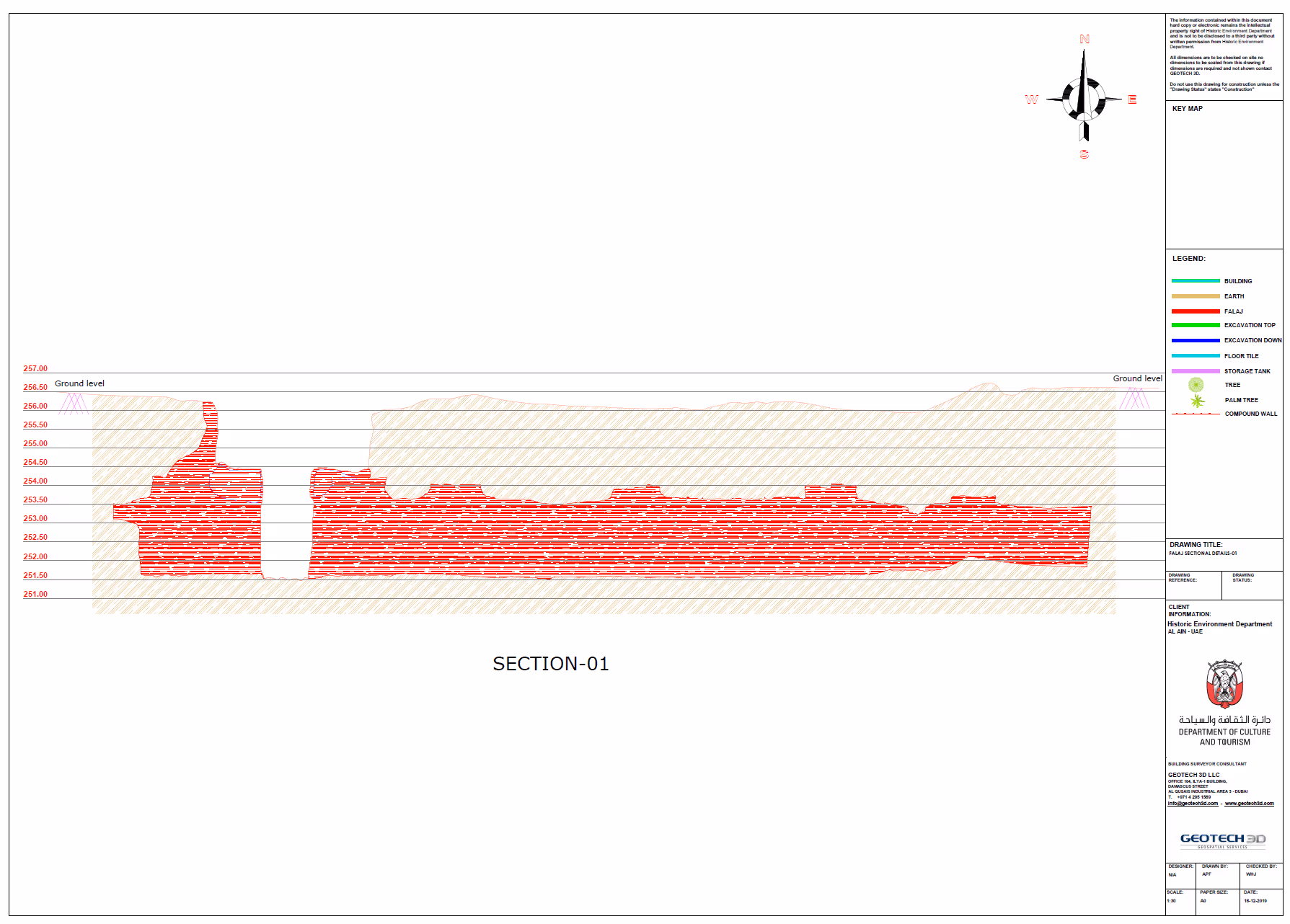
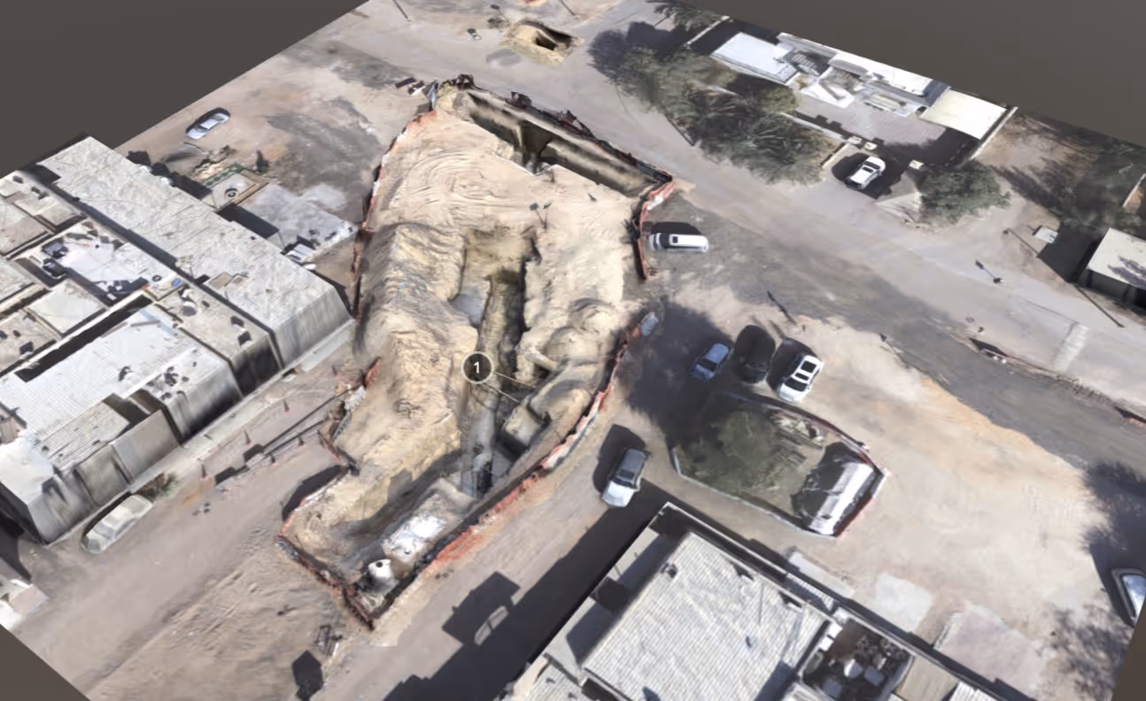
A new manhole was created in the street to allow ongoing inspection of the condition of the tunnel will allow us to monitor the rate of decay and inform future strategies for conservation and stabilization.
EM Road 1runs from north to south and forms the border between the adjacent shabiyaat of Eidan Al Mahaba (EM) and Falaj Al Mazmi (FAM). Installation of deep storm drains formed a major part of the Al Ain Municipality (AAM) project to upgrade roads and infrastructure in these areas, and this road was the first to be archaeologically monitored.
24.276160
55.775743
WGS84 / UTM zone 40N
Geotech 3D
9/12/2019
Al Kharafi
Eidan Al Mahaba
Road 1 + new name
Al Ain Municipality
ghayl falaj
24/11/2019
05/01/2020
Learn how we reference architectural elements in sites.
Iron Age II 1100-800 BCE
1 of 0
Image #1211
3D scanning inside the falaj
.jpg)
1 of 0
Image #1211
photogrammetric survey works
.jpg)
1 of 0
Image #1211
site works
.jpg)
1 of 0
Image #1211
site works
.jpg)
1 of 0
Image #1211
site works
.jpg)
1 of 0
Image #1211
site works
.jpg)
1 of 0
Image #1211
site works
.jpg)
1 of 0
Image #1211
site works
.jpg)
1 of 0
Image #1211
site works
Terms of Use
Aflaj Discoveries owns the copyright to all materials displayed on the website www.aflajdiscoveries.ae(“Aflaj Discoveries Website”), including but not limited to:
(i) the artwork, design, and layout of the Aflaj Discoveries Website; and
(ii) all electronic text, image files, audio, and video clips available on theWebsite (“Aflaj Discoveries Material”), unless otherwise indicated.
The saving, copying, or printing of AflajDiscoveries Material is permitted only under the principle of fair use.Fair use includes personal information, research, and academic study. By usingany Aflaj Discoveries Material, users agree to restrict their use to fair usethat does not infringe on the rights of Aflaj Discoveries. Users must alwayscite:
“Aflaj Discoveries by DCT” and include the website link www.aflajdiscoveries.ae.
Any republication of Aflaj DiscoveriesMaterial for public or commercial use without prior written approval isstrictly prohibited.
Academic & Research Use
Aflaj Discoveries Material is madeavailable primarily for cultural, educational, and scientific purposes.Academic and non-profit uses are allowed, provided proper credit is given andprior contact is made where applicable.
Commercial Use Requests
Users seeking to use Aflaj DiscoveriesMaterial for any commercial purpose must submit a written request including:
(i) identification of the material to be used; and
(ii) a description of the proposed commercial use.
Requests should be sent to: Aflajdiscoveries@dctabudhabi.ae
Aflaj Discoveries reserves the right toreview requests and charge fees for approved commercial uses.
Instructions for Requesting Use
If you would like to use audiovisualmaterial from the website, please:
- Note the filename, image number, or the link to the relevant page.
- Send an email to Aflajdiscoveries@dctabudhabi.ae.
- Include the filename(s)/number(s)/links in the subject line.
- In the body of the email, describe the proposed use clearly.
- For multiple images, files, or plans, list them all in one email.
Our team will review your request andrespond by email.
Note:Materials not credited to Aflaj Discoveries are not available for use(commercial or non-commercial). In such cases, users must contact thephotographer, museum, institute, or project directly.
Resources for finding out more about the aflaj and the ancient landscape of Al Ain